
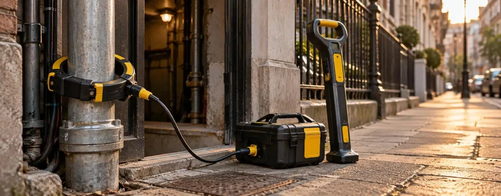
Utility Mapping Surveyors in Herefordshire
Get in TouchAt Site Metric Surveys, we provide comprehensive utility mapping surveys in Herefordshire and the surrounding HR4 9 postcode area. Our experienced team uses advanced techniques to accurately detect underground utilities such as gas, water, and electrical lines.
We serve a wide range of clients, including construction firms and property developers, ensuring safe and efficient project execution. Contact us today to discuss your specific needs and get a detailed utility assessment.
What Is a Utility Mapping Survey?
A utility mapping survey identifies and maps underground utility networks, essential for avoiding disruptions during development. At Site Metric Surveys, we use ground-penetrating radar (GPR) and electromagnetic induction techniques to detect utilities such as water pipes, gas lines, electrical cables, and fibre optic networks.
Our equipment, including the latest GPR systems, offers precise data, detecting utilities buried up to several metres deep. We also employ GPS and GIS technology to create detailed, geo-referenced utility maps.
This process helps prevent costly errors during construction by providing accurate location data, ensuring safety and compliance with local regulations like the British Standards Institution (BSI) PAS 128. Our mapping services are indispensable for construction projects, site planning, highways maintenance, and land acquisition processes.
Engaging our services early in your project can significantly reduce risks and ensure efficient resource management.
How Much Does a Utility Mapping Survey Cost in Herefordshire?
Utility mapping surveys in Herefordshire typically cost from £500 to £1,500, depending on the site's size and complexity. The price may vary based on additional factors such as the presence of underground utilities like gas, water mains, and electrical cables, which require specialised detection methods.
We use techniques such as ground-penetrating radar (GPR) and electromagnetic location (EML) to identify and map these utilities accurately.
Site characteristics such as urban density and ground conditions can further influence the survey duration and cost. For instance, densely populated areas may require more detailed analysis, while rocky or sandy soils may affect the equipment used.
At Site Metric Surveys, we assess factors such as the number of utilities and the technology required to provide an accurate quote. Contact us today to request a customised estimate and ensure a precise evaluation of your site.
Book Utility Mapping Surveyors Today
Why Choose Site Metric Surveys for Utility Mapping in Herefordshire?
Choosing Site Metric Surveys for utility mapping in Herefordshire means benefiting from our technology and experienced professionals. We employ Ground Penetrating Radar (GPR) and Electromagnetic Location (EML) equipment, which allow us to detect subsurface utilities with precision.
Our use of GPS and Geographic Information Systems (GIS) ensures that our mapping is both accurate and comprehensive, adhering to relevant industry standards such as PAS 128 for utility surveys.
Our team has extensive experience working with a wide range of clients, including construction companies, local councils, and property developers. We understand that efficient planning is crucial, and our surveys help to identify potential conflicts and reduce excavation risks, saving time and expense.
We offer detailed reports and CAD drawings to support project development.
Our commitment to efficiency and reliability makes us a valuable partner. Get in touch to learn how we can assist with your utility mapping needs today.
Speak to a Utility Mapping Surveyors Expert
What Are the Benefits of a Utility Mapping Survey in Herefordshire?
Utility mapping surveys offer several benefits for projects in Herefordshire. Using methods such as ground-penetrating radar (GPR) and electromagnetic location techniques, we precisely identify underground utilities like water pipes, gas lines, electrical cables, and telecommunications conduits.
This meticulous detection process can help prevent potential hazards such as accidental utility strikes, which can lead to costly project delays and safety incidents.
Accurate Utility Detection: Identify all underground utilities to avoid potential hazards, using advanced technologies such as GPR and electromagnetic sensors.
Cost Savings: Prevent project delays and structural damage through accurate mapping, saving on unexpected repair costs.
Improved Planning: Facilitate efficient site layout and construction strategies, ensuring each stage progresses smoothly with minimal disruption.
Regulatory Compliance: Ensure adherence to safety standards and local regulations, such as PAS 128 in the UK, which guides the utility survey process.
These advantages make utility mapping surveys an essential aspect of site preparation, ensuring projects are completed safely, on time, and within budget.
Frequently Asked Questions
How Often Should Utility Mapping Surveys Be Conducted?
At Site Metric Surveys, we recommend conducting utility mapping surveys when planning any new construction or significant site modifications in Herefordshire.
What Technology Do You Use for Utility Mapping?
We use ground-penetrating radar and electromagnetic techniques to deliver precise mapping results for projects in Herefordshire.
How Long Does a Utility Mapping Survey Take?
Most utility mapping surveys in Herefordshire take one to three days, depending on the area's size and complexity.
Is Utility Mapping Required for Residential Projects?
Yes, utility mapping is crucial for both residential and commercial projects to ensure safety and compliance during construction in Herefordshire.
Get a Free Quote for Utility Mapping in Herefordshire
For precise and reliable utility mapping surveys in Herefordshire, contact Site Metric Surveys.
We cover Herefordshire